Upper Derwent Visitor Centre — Sheffield
Uppshe two

Slow Way not verified yet. Verify Uppshe here.
Slow Way not verified yet. Verify Uppshe here.
By paudepaul on 31 May 2021
Description
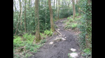
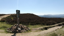
The route leaves Upper Derwent on well maintained paths before ascending up above Ladybower reservoir to Derwent edge. At this point the path becomes more rocky and rough. The path then descends towards A57 but goes north to avoid walking on the road. It then follows Rod Side which is a long but relatively quiet road. There are options to head into the Rivelin Valley but this route stays north of the valley following tracks which are more accessible to wheels. It then heads down and crosses the Rivelin Valley before ascending again into the outskirts of Sheffield, from here it is pavements down hill into the centre of Sheffield
The route leaves Upper Derwent on well maintained paths before ascending up above Ladybower reservoir to Derwent edge. At this point the path becomes more rocky and rough. The path then descends towards A57 but goes north to avoid walking on the road. It then follows Rod Side which is a long but relatively quiet road. There are options to head into the Rivelin Valley but this route stays north of the valley following tracks which are more accessible to wheels. It then heads down and crosses the Rivelin Valley before ascending again into the outskirts of Sheffield, from here it is pavements down hill into the centre of Sheffield
Status
This route has been reviewed by 2 people.
This route has been flagged (1 times) for reasons relating to access.
Photos for Uppshe two


Photos of this route will appear when they are added to a review. You can review this route here.
Information
Route status - Live
Reviews - 2
Average rating -
Is this route good enough? - Yes (1) Maybe (1)
Problems reported - Access (1)
Downloads - 2
Surveys
What is this route like?
Surveys are submitted by fellow users of this website and show what you might expect from this Slow Ways route. Scroll down the page to read more detailed surveys.
| Grade 4X based on 1 surveys | Sign up or log in to survey this route. | ||
|---|---|---|---|
| Description | Note | ||
| Grade 4: Route includes very rough surfaces including deep ruts, steep loose gravel, unmade paths and deep muddy sections. Wheelchairs may experience traction/wheel spin issues. Access grade X: At least one stile, flight of steps or other obstacle that is highly likely to block access for wheelchair and scooter users. |
Grading is based on average scores by surveyors. This slow way has 1 surveys. | ||
| Full grading description | |||
Only people who have completed our training can become Slow Ways surveyors and submit a survey. We do not vet contributors, so we cannot guarantee the quality or completeness of the surveys they complete. If you are dependent on the information being correct we recommend reading and comparing surveys before setting off.
Survey Photos

Facilities
Facilities in the middle third of this route.
Challenges
Potential challenges reported on this route. Some challenges are seasonal.
Obstacles
Obstacles on this route.
Accessibility
Is this route step and stile free?
Measurements
Surveyors were asked to measure the narrowest and steepest parts of paths.
The narrowest part of the path is 60.0cm (1)
The steepest uphill gradient East: no data
The steepest uphill gradient West: no data
The steepest camber: no data
How clear is the waymarking on the route: Clear (1)
Successfully completed
We asked route surveyors "Have you successfully completed this route with any of the following? If so, would you recommend it to someone with the same requirements?". Here is how they replied.
Recommended by an expert
We asked route surveyors "Are you a trained access professional, officer or expert? If so, is this route suitable for someone travelling with any of the following?" Here is how they replied.
Terrain
We asked route surveyors to estimate how much of the route goes through different kinds of terrain.
35.0% of the route is on roads (1)
20.0% of the route is lit at night (1)
55.0% of the route is paved (1)
25.0% of the route is muddy (1)
15.0% of the route is over rough ground (1)
There is no data on long grass
Report a problem with this data
1 surveys
Information from verified surveys.
Geography information system (GIS) data
Total length
Maximum elevation
Minimum elevation
Start and end points
Upper Derwent Visitor Centre
Grid Ref
SK1725689369
Lat / Lon
53.40088° / -1.74193°
Easting / Northing
417,256E / 389,369N
What3Words
standing.mandates.flick
Sheffield
Grid Ref
SK3580086930
Lat / Lon
53.37803° / -1.46332°
Easting / Northing
435,800E / 386,930N
What3Words
ledge.museum.hiding
| Upper Derwent Visitor Centre | |
|---|---|
| Grid Ref | SK1725689369 |
| Lat / Lon | 53.40088° / -1.74193° |
| Easting / Northing | 417,256E / 389,369N |
| What3Words | standing.mandates.flick |
| Sheffield | |
|---|---|
| Grid Ref | SK3580086930 |
| Lat / Lon | 53.37803° / -1.46332° |
| Easting / Northing | 435,800E / 386,930N |
| What3Words | ledge.museum.hiding |
Sorry Land Cover data is not currently available for this route. Please check back later.
Other Routes for Upper Derwent Visitor Centre—Sheffield See all Slow Ways
Review this better route and help establish a trusted network of walking routes.
Suggest a better route if it better meets our methodology.