Upper Derwent Visitor Centre — Sheffield
Uppshe two

Slow Way not verified yet. Verify Uppshe here.
Slow Way not verified yet. Verify Uppshe here.
By paudepaul on 31 May 2021
Description
The route leaves Upper Derwent on well maintained paths before ascending up above Ladybower reservoir to Derwent edge. At this point the path becomes more rocky and rough. The path then descends towards A57 but goes north to avoid walking on the road. It then follows Rod Side which is a long but relatively quiet road. There are options to head into the Rivelin Valley but this route stays north of the valley following tracks which are more accessible to wheels. It then heads down and crosses the Rivelin Valley before ascending again into the outskirts of Sheffield, from here it is pavements down hill into the centre of Sheffield
The route leaves Upper Derwent on well maintained paths before ascending up above Ladybower reservoir to Derwent edge. At this point the path becomes more rocky and rough. The path then descends towards A57 but goes north to avoid walking on the road. It then follows Rod Side which is a long but relatively quiet road. There are options to head into the Rivelin Valley but this route stays north of the valley following tracks which are more accessible to wheels. It then heads down and crosses the Rivelin Valley before ascending again into the outskirts of Sheffield, from here it is pavements down hill into the centre of Sheffield
Status
This route has been reviewed by 2 people.
This route has been flagged (1 times) for reasons relating to access.
Photos for Uppshe two


Photos of this route will appear when they are added to a review. You can review this route here.
Information
Route status - Live
Reviews - 2
Average rating -
Is this route good enough? - Yes (1) Maybe (1)
Problems reported - Access (1)
Downloads - 2
Surveys
What is this route like?
Surveys are submitted by fellow users of this website and show what you might expect from this Slow Ways route. Scroll down the page to read more detailed surveys.
| Grade 4X based on 1 surveys | Sign up or log in to survey this route. | ||
|---|---|---|---|
| Description | Note | ||
| Grade 4: Route includes very rough surfaces including deep ruts, steep loose gravel, unmade paths and deep muddy sections. Wheelchairs may experience traction/wheel spin issues. Access grade X: At least one stile, flight of steps or other obstacle that is highly likely to block access for wheelchair and scooter users. |
Grading is based on average scores by surveyors. This slow way has 1 surveys. | ||
| Full grading description | |||
Only people who have completed our training can become Slow Ways surveyors and submit a survey. We do not vet contributors, so we cannot guarantee the quality or completeness of the surveys they complete. If you are dependent on the information being correct we recommend reading and comparing surveys before setting off.
Survey Photos

Facilities
Facilities in the middle third of this route.
Challenges
Potential challenges reported on this route. Some challenges are seasonal.
Obstacles
Obstacles on this route.
Accessibility
Is this route step and stile free?
Measurements
Surveyors were asked to measure the narrowest and steepest parts of paths.
The narrowest part of the path is 60.0cm (1)
The steepest uphill gradient East: no data
The steepest uphill gradient West: no data
The steepest camber: no data
How clear is the waymarking on the route: Clear (1)
Successfully completed
We asked route surveyors "Have you successfully completed this route with any of the following? If so, would you recommend it to someone with the same requirements?". Here is how they replied.
Recommended by an expert
We asked route surveyors "Are you a trained access professional, officer or expert? If so, is this route suitable for someone travelling with any of the following?" Here is how they replied.
Terrain
We asked route surveyors to estimate how much of the route goes through different kinds of terrain.
35.0% of the route is on roads (1)
20.0% of the route is lit at night (1)
55.0% of the route is paved (1)
25.0% of the route is muddy (1)
15.0% of the route is over rough ground (1)
There is no data on long grass
Report a problem with this data
1 surveys
Information from verified surveys.
Geography information system (GIS) data
Total length
Maximum elevation
Minimum elevation
Start and end points
Upper Derwent Visitor Centre
Grid Ref
SK1725689369
Lat / Lon
53.40088° / -1.74193°
Easting / Northing
417,256E / 389,369N
What3Words
standing.mandates.flick
Sheffield
Grid Ref
SK3580086930
Lat / Lon
53.37803° / -1.46332°
Easting / Northing
435,800E / 386,930N
What3Words
ledge.museum.hiding
| Upper Derwent Visitor Centre | |
|---|---|
| Grid Ref | SK1725689369 |
| Lat / Lon | 53.40088° / -1.74193° |
| Easting / Northing | 417,256E / 389,369N |
| What3Words | standing.mandates.flick |
| Sheffield | |
|---|---|
| Grid Ref | SK3580086930 |
| Lat / Lon | 53.37803° / -1.46332° |
| Easting / Northing | 435,800E / 386,930N |
| What3Words | ledge.museum.hiding |
Sorry Land Cover data is not currently available for this route. Please check back later.
reviews
PeteS
06 May 2024I walked this in early May on a fine day, starting at Fairholmes visitors centre. The weather had been mostly dry beforehand. It took just over 4 hours with no stops. It shares segments with other UppShe routes, so there is some overlap with reviews there.
Cyclists can follow a lot of the route, but must take a bridleway further south across Derwent moor, should pass through Moorwood at the end of Rodside instead of taking the footpath, and when crossing the Rivelin at Tofts will have to work a route out to get to the top of Crookes, probably using Long Lane, etc. The route passes through fields of sheep with lambs so dogs must be on leads.
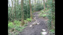
My dark peak map got me as far as the urban part of Sheffield. You'll want to wear boots if it's been raining. Only the crossing of Derwent Moor has rough ground and there is a paved path up half of it and a good track across the heather thereafter.
The ground is road until you turn off to climb the moor. That path is a stone slabs until you get past 3 barns where it turns to dirt track. From there you're on dirt and heather until Moscar Cross where it's mostly farm tracks and then roads to the River Rivelin in the valley bottom. The long, steep climb to the top of the hill is along woodland paths, which can be muddy, although I did finish with mostly clean boots. At the top, you emerge onto city streets and descend to the finish. There are some stiles and gates, and an S-shaped chicane/gate at the Rivelin bridge.
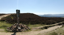
There are a few things to see en route. The Derwent dam is an impressive sight when the water is flowing over the wall. You can walk 5 minutes up the road to see a small statue to the Dambusters and also a memorial behind a locked gate. The route takes you right past Moscar Cross. Brontë fans will be pleased to note that this is supposedly Whitcross, the place where Jane Eyre was chucked off the coach when she fled Thornfield Hall. You'll only pass the Rivelin briefly but the bridge is next to the pond that used to feed the Hind Wheel used to grind cutlery. Needless to say, the views all along the route are impressive, even the view of the city from the top as you walk down to town. At the end of Conduit Road in Sheffield, is Weston Park museum, which is free, although it's worth a trip in itself. Blake Street - England's 3rd steepest street - is about half a km away on the same side of the hill as Conduit. Overall, I prefer the UppShe3 route, which stays by the Rivelin, rather than taking the road, but you do get to see more on this one, walking up on the hillside along the valley. This one does let you make good time, too.
Route-finding was easy for the most part. The turn-off from the side of Ladybower up to Derwent Moor is shortly after a loop in the path to cross over a stream via a bridge. At the turn-off, there is a gate across the road, and another gate next to it which is across the uphill path that you want. Keep going up, through a small yard with 3 barns. The path passes along the top edge of some trees and at the end of that, cross the open moor on a maze of tracks to get up to the 4 or 5-way junction on top of Derwent Moor. That maze of tracks will be invisible in snow, so aim for the rightmost rock formation, "Wheel Stones", on the skyline (if you can see it). The junction is a few hundred metres to the south of them and has a sign post that points you to Moscar.
After a long march along the road at RodSide, the path to turn onto is at a 3-way road junction, with the path forming a fourth way. That goes South a few minutes before you go East again at a copse and farmhouse. The paths through the woods on the South side of the Rivelin are a bit of a maze. Once over the river, and a little up the side, you generally walk along the hill side rather than up or down it. The path in the wood parallels an open field downhill of you until it reaches Holly Hagg farm. The path goes below the southern farm edge, over the road, through some allotments, and then into the carpark where you turn uphill, crossing the road and a stile, and climb Jackey Bank up to a housing estate.
The most important hazard would be the weather. Do check the mountain weather forecast. Like the other reviewer, I wasn't keen on some of the road sections. I didn't mind the traffic so much on Rod Side, which is extremely light and on a long, straight road with good visiblity. The road through Bingley is busier and so more likely to have both ways passing at once. This stretch is a lot shorter though. The climb up Jackey Bank to Crookes is a mudslide after heavy rain, despite having some steps, and it's easy to slip, especially coming down.
At the start there are toilets, information and a food and drink kiosk that proudly claims to be open every day except Christmas Day from 0800 while 1800. The third of the 3 barns I mentioned above has a bench inside and makes a good spot for a break. There's not much between there to Flash Farm which has another bench just before the turn down Dobb Lane. When you get to Tofts, the Rivelin pub a chance to sit down or more. At the top of the valley, you'll pass through Crookes main street where there are shops, cafés and takeaways. And after that is Sheffield city centre.
To get to Fairholmes on public transport, there is a Hulleys' 257 bus from Sheffield. On Monday-Saturdays, only 1 bus goes from Sheffield in the morning and only 1 bus goes back again in the evening. There are more Sunday services. Check Hulleys' web site. I have no information about other public transport links there. Bamford station is nearest railway station but it's a way to go. At the end of Bingley Lane, the 81 Stannington to Sheffield bus is very near the route. From Crookes shops there is the 52/52a, and from Glossop Road onwards there are a number of transport services, although you're near the end by then.
Andy Hobson
06 May 2022There is a long stretch of road waling on this road, it is only a B road but, the cars do come past at speed on the road and there are no footpaths. There are alternative routes that can be used, they are slightly longer but, you wouldn't spend as much time on the road.
-
Share your thoughts
Share your views about this route, give it a star rating, indicate whether it should be verified or not.
Include information that will be useful to others considering to walk or wheel it.
You can add up to 15 photos.
Other Routes for Upper Derwent Visitor Centre—Sheffield See all Slow Ways
Review this better route and help establish a trusted network of walking routes.
Suggest a better route if it better meets our methodology.
Share your thoughts