Description
Via Putney Green Man, Putney Common, Tippet's Corner, Wimbledon Common and Wimbledon Village.
Plenty of the sort of green spaces this part of London is known for, and a few necessary roads, also reasonably direct.
This route is a rework of Putwim One; it corrects the random drawing on Wimbledon Common, and makes a few other alterations, better to use the commons, and takes a quieter route into/out of Wimbledon.
Can be muddy after rain; a few steps downhill on the way into Wimbledon (or uphill on the way out). Refreshments at Putney Green Man, including a decent roadside takeaway cafe-hut by the buses if you don't fancy the pub (or its too early); and at Wimbledon Village
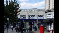
Status
This route has been reviewed by 4 people.
There are no issues flagged.
Photos for Putwim two


Photos of this route will appear when they are added to a review. You can review this route here.
Information
")
Route status - Live
Reviews - 4
Average rating -
Is this route good enough? - Yes (4)
There are currently no problems reported with this route.
Downloads - 4
Surveys
We are working to build-up a picture of what routes look like. To do that we are asking volunteers to survey routes so that we can communicate features, obstacles and challenges that may make a route desirable or not.
Slow Ways surveyors are asked to complete some basic online training, but they are not vetted. If you are dependent on the survey information being correct in order to complete a route, we recommend that you think critically about the information provided. You may also wish to wait until more than one survey has been completed.
Help people know more about this route by volunteering to submit a survey.
- Complete the survey training.
- Submit a survey for this route.
Geography information system (GIS) data
Total length
Maximum elevation
Minimum elevation
Start and end points
Putney
Grid Ref
TQ2398075091
Lat / Lon
51.46122° / -0.21674°
Easting / Northing
523,980E / 175,091N
What3Words
factories.whips.slave
Wimbledon
Grid Ref
TQ2477170654
Lat / Lon
51.42117° / -0.20692°
Easting / Northing
524,771E / 170,654N
What3Words
swung.reap.park
| Putney | |
|---|---|
| Grid Ref | TQ2398075091 |
| Lat / Lon | 51.46122° / -0.21674° |
| Easting / Northing | 523,980E / 175,091N |
| What3Words | factories.whips.slave |
| Wimbledon | |
|---|---|
| Grid Ref | TQ2477170654 |
| Lat / Lon | 51.42117° / -0.20692° |
| Easting / Northing | 524,771E / 170,654N |
| What3Words | swung.reap.park |
Sorry Land Cover data is not currently available for this route. Please check back later.
Other Routes for Putney—Wimbledon See all Slow Ways
Review this better route and help establish a trusted network of walking routes.
Suggest a better route if it better meets our methodology.