Lancaster — High Bentham
Lanchig two

Slow Way not verified yet. Verify Lanchig here.
Slow Way not verified yet. Verify Lanchig here.
By Mary Oz on 22 Dec 2022
Description
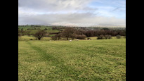
I didn’t fancy the amount of road walking of Lanchig One, especially at the Lancaster end east of the motorway, where it has two lanes with little verge. Also, as it is such a long route, I wanted more bailout villages on the way. The result would have been very good if the Lune Valley Ramble had been a bit more reliable!
I didn’t fancy the amount of road walking of Lanchig One, especially at the Lancaster end east of the motorway, where it has two lanes with little verge. Also, as it is such a long route, I wanted more bailout villages on the way. The result would have been very good if the Lune Valley Ramble had been a bit more reliable!
Status
This route has been reviewed by 1 person.
There are no issues flagged.
Photos for Lanchig two


Photos of this route will appear when they are added to a review. You can review this route here.
Information
Route status - Live
Reviews - 1
Average rating -
Is this route good enough? - Yes (1)
There are currently no problems reported with this route.
Downloads - 0
Surveys
What is this route like?
Surveys are submitted by fellow users of this website and show what you might expect from this Slow Ways route. Scroll down the page to read more detailed surveys.
| Grade 4X based on 1 surveys | Sign up or log in to survey this route. | ||
|---|---|---|---|
| Description | Note | ||
| Grade 4: Route includes very rough surfaces including deep ruts, steep loose gravel, unmade paths and deep muddy sections. Wheelchairs may experience traction/wheel spin issues. Access grade X: At least one stile, flight of steps or other obstacle that is highly likely to block access for wheelchair and scooter users. |
Grading is based on average scores by surveyors. This slow way has 1 surveys. | ||
| Full grading description | |||
Only people who have completed our training can become Slow Ways surveyors and submit a survey. We do not vet contributors, so we cannot guarantee the quality or completeness of the surveys they complete. If you are dependent on the information being correct we recommend reading and comparing surveys before setting off.
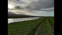
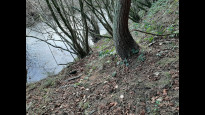
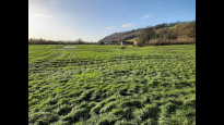
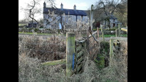
Survey Photos
Facilities
Facilities in the middle third of this route.
Challenges
Potential challenges reported on this route. Some challenges are seasonal.
Obstacles
Obstacles on this route.
Accessibility
Is this route step and stile free?
Measurements
Surveyors were asked to measure the narrowest and steepest parts of paths.
The narrowest part of the path is 10.0cm (1)
The steepest uphill gradient walking East 40.0% (1)
The steepest uphill gradient walking West 40.0% (1)
The steepest camber gradient across the path 20.0% (1)
How clear is the waymarking on the route: Unclear in places (1)
Successfully completed
We asked route surveyors "Have you successfully completed this route with any of the following? If so, would you recommend it to someone with the same requirements?". Here is how they replied.
Recommended by an expert
We asked route surveyors "Are you a trained access professional, officer or expert? If so, is this route suitable for someone travelling with any of the following?" Here is how they replied.
Terrain
We asked route surveyors to estimate how much of the route goes through different kinds of terrain.
18.0% of the route is on roads (1)
30.0% of the route is lit at night (1)
35.0% of the route is paved (1)
20.0% of the route is muddy (1)
10.0% of the route is over rough ground (1)
10.0% of the route is through long grass (1)
Report a problem with this data
1 surveys
Information from verified surveys.
Geography information system (GIS) data
Total length
Maximum elevation
Minimum elevation
Start and end points
Lancaster
Grid Ref
SD4718261726
Lat / Lon
54.04879° / -2.80819°
Easting / Northing
347,182E / 461,726N
What3Words
lace.tight.agree
High Bentham
Grid Ref
SD6683269256
Lat / Lon
54.11811° / -2.50892°
Easting / Northing
366,832E / 469,256N
What3Words
prune.waxes.prowess
| Lancaster | |
|---|---|
| Grid Ref | SD4718261726 |
| Lat / Lon | 54.04879° / -2.80819° |
| Easting / Northing | 347,182E / 461,726N |
| What3Words | lace.tight.agree |
| High Bentham | |
|---|---|
| Grid Ref | SD6683269256 |
| Lat / Lon | 54.11811° / -2.50892° |
| Easting / Northing | 366,832E / 469,256N |
| What3Words | prune.waxes.prowess |
Sorry Land Cover data is not currently available for this route. Please check back later.
Other Routes for Lancaster—High Bentham See all Slow Ways
Review this better route and help establish a trusted network of walking routes.
Suggest a better route if it better meets our methodology.