Innsworth — Cheltenham
Innche one

Slow Way not verified yet. Verify Innche here.
Slow Way not verified yet. Verify Innche here.
By a Slow Ways Volunteer on 07 Apr 2021
Description
This is a Slow Ways route connecting Innsworth and Cheltenham.
Know of a better route? Share it here.
This is a Slow Ways route connecting Innsworth and Cheltenham.
Know of a better route? Share it here.
Status
This route has been reviewed by 2 people.
There are no issues flagged.
Photos for Innche one


Photos of this route will appear when they are added to a review. You can review this route here.
Information
Route status - Live
Reviews - 2
Average rating -
Is this route good enough? - Yes (2)
There are currently no problems reported with this route.
Downloads - 9
Surveys
What is this route like?
Surveys are submitted by fellow users of this website and show what you might expect from this Slow Ways route. Scroll down the page to read more detailed surveys.
| Grade 3X based on 1 surveys | Sign up or log in to survey this route. | ||
|---|---|---|---|
| Description | Note | ||
| Grade 3: Route includes rough surfaces that may include small boulders, potholes, shallow ruts, loose gravel, short muddy sections. Access grade X: At least one stile, flight of steps or other obstacle that is highly likely to block access for wheelchair and scooter users. |
Grading is based on average scores by surveyors. This slow way has 1 surveys. | ||
| Full grading description | |||
Only people who have completed our training can become Slow Ways surveyors and submit a survey. We do not vet contributors, so we cannot guarantee the quality or completeness of the surveys they complete. If you are dependent on the information being correct we recommend reading and comparing surveys before setting off.
Survey Photos
Facilities
Facilities in the middle third of this route.
Challenges
Potential challenges reported on this route. Some challenges are seasonal.
Obstacles
Obstacles on this route.
Accessibility
Is this route step and stile free?
Measurements
Surveyors were asked to measure the narrowest and steepest parts of paths.
The narrowest part of the path is 50.0cm (1)
The steepest uphill gradient East: no data
The steepest uphill gradient West: no data
The steepest camber: no data
How clear is the waymarking on the route: Unclear in places (1)
Successfully completed
We asked route surveyors "Have you successfully completed this route with any of the following? If so, would you recommend it to someone with the same requirements?". Here is how they replied.
Recommended by an expert
We asked route surveyors "Are you a trained access professional, officer or expert? If so, is this route suitable for someone travelling with any of the following?" Here is how they replied.
Terrain
We asked route surveyors to estimate how much of the route goes through different kinds of terrain.
2.0% of the route is on roads (1)
50.0% of the route is lit at night (1)
60.0% of the route is paved (1)
2.0% of the route is muddy (1)
There is no data on rough ground
1.0% of the route is through long grass (1)
Report a problem with this data
1 surveys
Information from verified surveys.
Geography information system (GIS) data
Total length
Maximum elevation
Minimum elevation
Start and end points
Innsworth
Grid Ref
SO8728021092
Lat / Lon
51.88824° / -2.18622°
Easting / Northing
387,280E / 221,092N
What3Words
napped.detriment.producing
Cheltenham
Grid Ref
SO9473022366
Lat / Lon
51.89982° / -2.07799°
Easting / Northing
394,730E / 222,366N
What3Words
escape.press.storms
Innche One's land is
| Innsworth | |
|---|---|
| Grid Ref | SO8728021092 |
| Lat / Lon | 51.88824° / -2.18622° |
| Easting / Northing | 387,280E / 221,092N |
| What3Words | napped.detriment.producing |
| Cheltenham | |
|---|---|
| Grid Ref | SO9473022366 |
| Lat / Lon | 51.89982° / -2.07799° |
| Easting / Northing | 394,730E / 222,366N |
| What3Words | escape.press.storms |
| Arable | 6.7% |
| Pasture | 14.4% |
| Urban | 78.8% |
Data: Corine Land Cover (CLC) 2018
reviews
Hugh Hudson
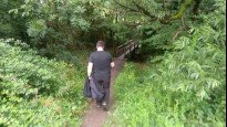
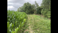
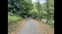
22 Jul 2023 (edited 24 Jul 2023)Walked from Innsworth to Cheltenham. A good and fairly direct route, let down a little by some very lazy and approximate GPX plotting. There are also places where the paths on the ground deviate a little from the right of way lines shown on the OS 1:25000 map. The middle section is unsurfaced and has a few stiles, and some of the paths through outer Cheltenham are a little overgrown, but there are no major problems.
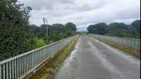
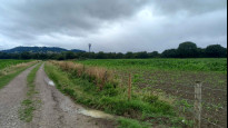
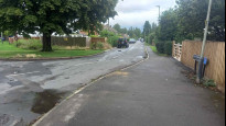
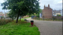
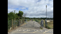
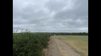
From the Hare and Hounds in Innsworth, we head east along Parton Road and cross the A40, then turn left through a park's car park and continue until the path reaches a bridge over a brook by the main road. Just beyond the brook (ignore the right of way line which starts on the wrong side of the stream) and follow the field edge far right. This path has a number of stiles. Beyond a farm lane the path is less distinct but the route right of the farm is partly waymarked. There is no need to cross the hedge beyond the farm, as there is a stile at the motorway bridge.
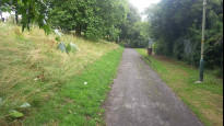
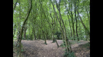
Beyond the bridge there is little sign of anyone trying to take the right of way lines literally, so just follow the track out to Badgeworth Road. The GPX plotting of this section is very lazy - it is not a straight line and as Mike noted we walk along The Reddings (pavement on right hand side) not through the houses and gardens. Old Reddings Road takes us down to the railway, where we follow a surfaced but rather overgrown path. At Hatherley Lane the GPX misses another subtlety, as the path heads left just before the lane and we have to follow the lane right a little to pick up the continuation. Beyond Willersey Lane there is more lazy GPX plotting - beyond the first bridge it is easiest to leave the paved path through the grassy area to find the second bridge.
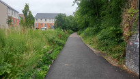
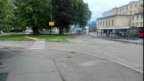
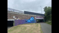
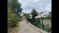
Another alleyway takes us to Granley Road, and from here we use pavements to reach the railway station. We cross the bridge on Queens Road to pick up the popular cycle track along the old railway, following it under St Georges Road and following the Chelt out to St Georges Place. From here an easy pavement walk takes us to the Royal Well bus station and the Cheltenham meeting point.
Mtormey
04 Aug 2022I walked this route from Innsworth to Cheltenham. I really enjoyed it.
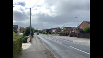
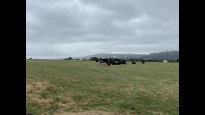
Parton Road is a bit busy, but the pavements are of sufficient width for comfortable walking. The bit of off-road walking to Badgeworth Road is very lovely. Just be warned that I encountered cows (who barely even looked up as I passed) in a few of the fields when I walked in August.
The route as plotted has you walking straight behind the buildings that line The Reddings, but that's not a footpath; just follow The Reddings.
The stretch of the route into Cheltenham was good, it just felt very long! There was comfortable pavement walking along quiet streets, there was the path along the rail line (overgrown in parts), there was a bit through a neighbourhood park, there was a bit along larger roads to the railway station, and there was a bit along the Honeybourne Line and the river that take you very comfortably into town. It was all good and varied, it just felt very long!
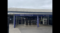
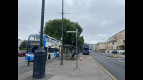
The node is in a funny point, kind of in behind the main town centre, but located at the main bus and coach station for easy transit elsewhere.
Overall, a very good route!.
-
Share your thoughts
Share your views about this route, give it a star rating, indicate whether it should be verified or not.
Include information that will be useful to others considering to walk or wheel it.
You can add up to 15 photos.
There are no other routes for Innsworth — Cheltenham
If you know a better way, then please let us know.
Review this better route and help establish a trusted network of walking routes.
Suggest a better route if it better meets our methodology.
Share your thoughts