Description
This is a Slow Ways route connecting Hatfield and Welwyn Garden City.
Know of a better route? Share it here.
This is a Slow Ways route connecting Hatfield and Welwyn Garden City.
Know of a better route? Share it here.
Status
This route has been reviewed by 4 people.
There are no issues flagged.
Photos for Hatwel one


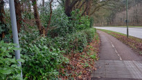
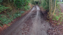
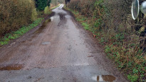
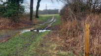

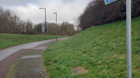
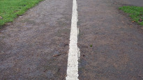
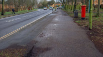
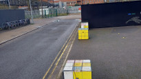


Photos of this route will appear when they are added to a review. You can review this route here.
Information
")
Route status - Live
Reviews - 4
Average rating -
Is this route good enough? - Yes (4)
There are currently no problems reported with this route.
Downloads - 7
Surveys
What is this route like?
Surveys are submitted by fellow users of this website and show what you might expect from this Slow Ways route. Scroll down the page to read more detailed surveys.
| Grade 3X based on 1 surveys | Sign up or log in to survey this route. | ||
|---|---|---|---|
| Description | Note | ||
| Grade 3: Route includes rough surfaces that may include small boulders, potholes, shallow ruts, loose gravel, short muddy sections. Access grade X: At least one stile, flight of steps or other obstacle that is highly likely to block access for wheelchair and scooter users. |
Grading is based on average scores by surveyors. This slow way has 1 surveys. | ||
| Full grading description | |||
Only people who have completed our training can become Slow Ways surveyors and submit a survey. We do not vet contributors, so we cannot guarantee the quality or completeness of the surveys they complete. If you are dependent on the information being correct we recommend reading and comparing surveys before setting off.
Survey Photos
Facilities
Facilities in the middle third of this route.
Challenges
Potential challenges reported on this route. Some challenges are seasonal.
Obstacles
Obstacles on this route.
Accessibility
Is this route step and stile free?
Measurements
Surveyors were asked to measure the narrowest and steepest parts of paths.
The narrowest part of the path is 60.0cm (1)
The steepest uphill gradient walking East 8.0% (1)
The steepest uphill gradient walking West 9.0% (1)
The steepest camber gradient across the path 4.0% (1)
How clear is the waymarking on the route: Unsigned (1)
Successfully completed
We asked route surveyors "Have you successfully completed this route with any of the following? If so, would you recommend it to someone with the same requirements?". Here is how they replied.
Recommended by an expert
We asked route surveyors "Are you a trained access professional, officer or expert? If so, is this route suitable for someone travelling with any of the following?" Here is how they replied.
Terrain
We asked route surveyors to estimate how much of the route goes through different kinds of terrain.
60.0% of the route is on roads (1)
65.0% of the route is lit at night (1)
65.0% of the route is paved (1)
20.0% of the route is muddy (1)
20.0% of the route is over rough ground (1)
6.0% of the route is through long grass (1)
Report a problem with this data
1 surveys
Information from verified surveys.
Geography information system (GIS) data
Total length
Maximum elevation
Minimum elevation
Start and end points
Hatfield
Grid Ref
TL2326608757
Lat / Lon
51.76394° / -0.21519°
Easting / Northing
523,266E / 208,757N
What3Words
most.play.pinks
Welwyn Garden City
Grid Ref
TL2394412898
Lat / Lon
51.80101° / -0.20389°
Easting / Northing
523,944E / 212,898N
What3Words
sits.emerge.gross
Hatwel One's land is
| Hatfield | |
|---|---|
| Grid Ref | TL2326608757 |
| Lat / Lon | 51.76394° / -0.21519° |
| Easting / Northing | 523,266E / 208,757N |
| What3Words | most.play.pinks |
| Welwyn Garden City | |
|---|---|
| Grid Ref | TL2394412898 |
| Lat / Lon | 51.80101° / -0.20389° |
| Easting / Northing | 523,944E / 212,898N |
| What3Words | sits.emerge.gross |
| Other agricultural land | 27.6% |
| Urban | 71.1% |
| Woods | 1.3% |
Data: Corine Land Cover (CLC) 2018
reviews
Strider
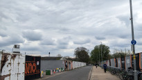
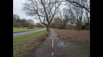
10 Feb 2024I walked from Hatfield to Welwyn.
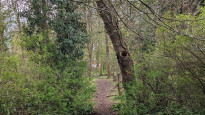
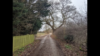
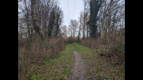
Pavement / cycle path walking at either end beside busy roads, not very exciting. But the middle is really very pleasant, I even managed to find the 'missing path' mentioned by previous reviewers (forewarned is forearmed). No big hills.
Even with recent torrential rain the paths were wet but but not bad.
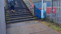
Steps into the station/shopping centre.
Callum
16 Apr 2023I walked this from Welwyn Garden to Hatfield.
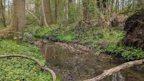
The Welwyn half was fairly dull, with walking essentially one main road for a long time (Broadwater / Chequers). Broadwater particularly is fairly depressing in my opinion, with the new apartments going up there; it feels like a commuter wasteland. However, once you get to Chequers, if you walk on the other side of the road than the route, it does become pleasanter (map pictured below). If you're adventurous at the end of Chequers you can also walk a very brambly (not really a) path along a little stream (also pictured).
After that, I enjoyed it quite a lot. Particularly the last stretch into old Hatfield, where the modernist Park Meadow Estate was very nice.
Would you walk it again?
Yes I think so. Though if I wanted a slightly longer but nicer walk to Hatfield, I would walk down Parkway in WGC to Stanborugh Lakes and use the route from there.
Would you suggest it to others?
Yes I would, although I'd also suggest the Parkway alternative just mentioned.
Is it reasonably safe?
Yes although I probably wouldn't do the more rural sections in the dark (but that's obvious).
Is it reasonably accurate?
Yes, although as others have mentioned, the cut across the field at Woodhall Farm isn't there, or at least when the field has been ploughed.
Does it have access issues?
At WGC station, there are stairs from the railway bridge.
-
Share your thoughts
Heather S.
01 Jan 2023For what this path is - a direct route between two reasonably populated towns - it is fine. Most of it is on easy to navigate cycle paths near the roadside with only one small stretch through the countryside. As mentioned the path directly across the field shown on maps is not visible, but a detour is easy. After several days of rain parts were flooded but still traversable.
-
Share your thoughts
Derick Rethans
19 Feb 2022This was an easy to follow route. The walk north out of Hatfield was a little tricky to follow, and the busy road just north of Hatfield was not that great. Once between the busy road and Hatfield Hyde it was nice, although muddy and up hill. The path through the field (along a public footpath) wasn't accessible as it wasn't clearer, so I had to walk around the field which added a bit of time. It is definitely a good an easy enough to follow route.
-
Share your thoughts
Share your views about this route, give it a star rating, indicate whether it should be verified or not.
Include information that will be useful to others considering to walk or wheel it.
You can add up to 15 photos.
There are no other routes for Hatfield — Welwyn Garden City
If you know a better way, then please let us know.
Review this better route and help establish a trusted network of walking routes.
Suggest a better route if it better meets our methodology.
Share your thoughts