Description
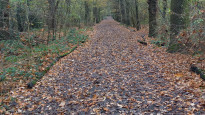
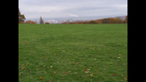
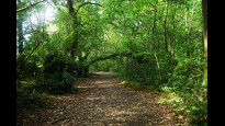
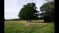
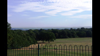
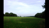
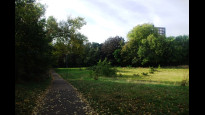
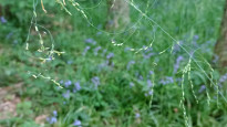
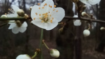
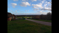
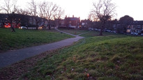
This is a neater, easier to navigate version of EltWoo 1 for people who'd like to meander their way from Woolwich to Eltham via the top of Shooters Hill. And why not? It's one of the tallest points in London, and as it's a freestanding peak it has particularly amazing views across south London, Kent and Essex. The shady ancient woodlands are pretty special too, Shepherdleas has beautiful bluebells, but the best views are from the top of Oxleas Meadow looking S at least. To look E over Kent go to Eaglesfield Park or look NE from the top of Shrewsbury Park main meadow.
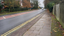
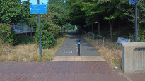
It's fairly easy to follow, uses the well signposted Green Chain Walk, without breaking away for multiple small diversions to save 10m here, or 15m there, or for no obvious reason (yes EltWoo 1 I AM looking at you!). Not having to pick your way along a overgrown back lane that's frequently blocked with flytipping is another improvement, along with more direct and quieter ways to get to the G C Walk from Eltham (to Eltham Pk North aka Shepherdleas Wood) and from Woolwich (up to Plumstead Common Rd).
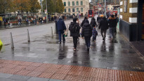
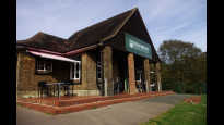
There are several shops etc along the way but the cafe at the top of Oxleas Meadow is great rest spot, there's a public toilet too. No train stations to break this journey but a few buses on Rochester Way, Shooters Hill or Plumstead Common Rd.
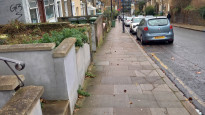
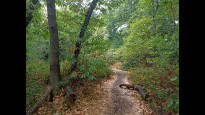
These woods have muddy sections even sometimes into summer. There are multiple steep bits and wood/banked earth steps along the path from Upton Rd into Shrewsbury Pk (TQ 4450 7753). The footpath/alley connecting Shrewsbury Pk and Mereworth Dr (TQ 4429 7697) may be locked at night but the park isn't locked, just the gate for cars and that one entrance. None of the other greenspaces on the route are locked either.
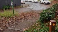
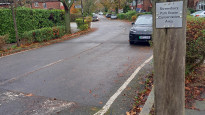
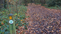
There are many more paths through these green spaces than shown on any map, particularly Shepherdleas and Oxleas Woods, so the Green Chain signs are a great help, but not perfect. They do get misaligned (at the top of Oxleas Meadow and at Shooters Hill!) but also check the destinations carefully, the Green Chain Walk is not linear, and it's more a green web than a chain, this area is peak-GCW, this route borrows bits from 3 sections, but crosses 3 others. A sign for the wrong branch may be alluring as it shares a destination with yours, if it rejoins with yours along the way. https://par.tfl.gov.uk/modes/walking/green-chain-walk
The middle section sticks to the Green Chain to save navigational effort, but EltWoo 2 is even easier guys, so use that if time or effort are a bother. Or, if you'd just love even more views in other directions then make up your own detour around the streets off Plum Lane, e.g. the top of Occupation Lane, Brent Rd, Brinklow Cres, or the other Shrewsbury Pk meadow next to Rowton Rd
This is a neater, easier to navigate version of EltWoo 1 for people who'd like to meander their way from Woolwich to Eltham via the top of Shooters Hill. And why not? It's one of the tallest points in London, and as it's a freestanding peak it has particularly amazing views across south London, Kent and Essex. The shady ancient woodlands are pretty special too, Shepherdleas has beautiful bluebells, but the best views are from the top of Oxleas Meadow looking S at least. To look E over Kent go to Eaglesfield Park or look NE from the top of Shrewsbury Park main meadow.
It's fairly easy to follow, uses the well signposted Green Chain Walk, without breaking away for multiple small diversions to save 10m here, or 15m there, or for no obvious reason (yes EltWoo 1 I AM looking at you!). Not having to pick your way along a overgrown back lane that's frequently blocked with flytipping is another improvement, along with more direct and quieter ways to get to the G C Walk from Eltham (to Eltham Pk North aka Shepherdleas Wood) and from Woolwich (up to Plumstead Common Rd).
There are several shops etc along the way but the cafe at the top of Oxleas Meadow is great rest spot, there's a public toilet too. No train stations to break this journey but a few buses on Rochester Way, Shooters Hill or Plumstead Common Rd.
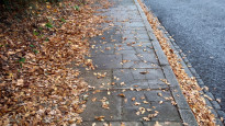
These woods have muddy sections even sometimes into summer. There are multiple steep bits and wood/banked earth steps along the path from Upton Rd into Shrewsbury Pk (TQ 4450 7753). The footpath/alley connecting Shrewsbury Pk and Mereworth Dr (TQ 4429 7697) may be locked at night but the park isn't locked, just the gate for cars and that one entrance. None of the other greenspaces on the route are locked either.
There are many more paths through these green spaces than shown on any map, particularly Shepherdleas and Oxleas Woods, so the Green Chain signs are a great help, but not perfect. They do get misaligned (at the top of Oxleas Meadow and at Shooters Hill!) but also check the destinations carefully, the Green Chain Walk is not linear, and it's more a green web than a chain, this area is peak-GCW, this route borrows bits from 3 sections, but crosses 3 others. A sign for the wrong branch may be alluring as it shares a destination with yours, if it rejoins with yours along the way. https://par.tfl.gov.uk/modes/walking/green-chain-walk
The middle section sticks to the Green Chain to save navigational effort, but EltWoo 2 is even easier guys, so use that if time or effort are a bother. Or, if you'd just love even more views in other directions then make up your own detour around the streets off Plum Lane, e.g. the top of Occupation Lane, Brent Rd, Brinklow Cres, or the other Shrewsbury Pk meadow next to Rowton Rd
Status
This route has been reviewed by 4 people.
There are no issues flagged.
Photos for Eltwoo three


Photos of this route will appear when they are added to a review. You can review this route here.
Information
")
Route status - Live
Reviews - 4
Average rating -
Is this route good enough? - Yes (4)
There are currently no problems reported with this route.
Downloads - 9
Surveys
What is this route like?
Surveys are submitted by fellow users of this website and show what you might expect from this Slow Ways route. Scroll down the page to read more detailed surveys.
| Grade 4X based on 1 surveys | Sign up or log in to survey this route. | ||
|---|---|---|---|
| Description | Note | ||
| Grade 4: Route includes very rough surfaces including deep ruts, steep loose gravel, unmade paths and deep muddy sections. Wheelchairs may experience traction/wheel spin issues. Access grade X: At least one stile, flight of steps or other obstacle that is highly likely to block access for wheelchair and scooter users. |
Grading is based on average scores by surveyors. This slow way has 1 surveys. | ||
| Full grading description | |||
Only people who have completed our training can become Slow Ways surveyors and submit a survey. We do not vet contributors, so we cannot guarantee the quality or completeness of the surveys they complete. If you are dependent on the information being correct we recommend reading and comparing surveys before setting off.
Survey Photos
Facilities
Facilities in the middle third of this route.
Challenges
Potential challenges reported on this route. Some challenges are seasonal.
Obstacles
Obstacles on this route.
Accessibility
Is this route step and stile free?
Measurements
Surveyors were asked to measure the narrowest and steepest parts of paths.
The narrowest part of the path is 60.0cm (1)
The steepest uphill gradient walking East 16.0% (1)
The steepest uphill gradient walking West 16.0% (1)
The steepest camber gradient across the path 4.0% (1)
How clear is the waymarking on the route: Unclear in places (1)
Successfully completed
We asked route surveyors "Have you successfully completed this route with any of the following? If so, would you recommend it to someone with the same requirements?". Here is how they replied.
Recommended by an expert
We asked route surveyors "Are you a trained access professional, officer or expert? If so, is this route suitable for someone travelling with any of the following?" Here is how they replied.
Terrain
We asked route surveyors to estimate how much of the route goes through different kinds of terrain.
30.0% of the route is on roads (1)
30.0% of the route is lit at night (1)
30.0% of the route is paved (1)
20.0% of the route is muddy (1)
15.0% of the route is over rough ground (1)
15.0% of the route is through long grass (1)
Report a problem with this data
1 surveys
Information from verified surveys.
Geography information system (GIS) data
Total length
Maximum elevation
Minimum elevation
Start and end points
Eltham
Grid Ref
TQ4271174900
Lat / Lon
51.45510° / 0.05263°
Easting / Northing
542,711E / 174,900N
What3Words
grows.chef.survey
Woolwich
Grid Ref
TQ4372878823
Lat / Lon
51.49009° / 0.06885°
Easting / Northing
543,728E / 178,823N
What3Words
legend.tester.drives
| Eltham | |
|---|---|
| Grid Ref | TQ4271174900 |
| Lat / Lon | 51.45510° / 0.05263° |
| Easting / Northing | 542,711E / 174,900N |
| What3Words | grows.chef.survey |
| Woolwich | |
|---|---|
| Grid Ref | TQ4372878823 |
| Lat / Lon | 51.49009° / 0.06885° |
| Easting / Northing | 543,728E / 178,823N |
| What3Words | legend.tester.drives |
Sorry Land Cover data is not currently available for this route. Please check back later.
reviews
Strider
04 Dec 2023I walked from Eltham to Woolwich.
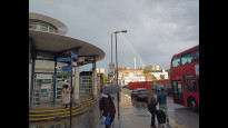
Is Eltham Station the most unimaginative building ever, set within a flat sea bricks?
Fortunately you can quickly leave it behind and enjoy a beautiful walk, eloquently described by Daisy C.
Steep in places, muddy when wet. Great views even on a grey winter's day. Lovely woods.
Not for wheels.
JohnMyerson
11 Oct 2023A really lovely walk through plenty of green spaces. I'd already walked from Bromley to Eltham Station. The A2 is noisy until you get into Shepherdleas Wood. I used the short cut along the surfaced path at the edge of Oxleas Meadow to get to the café for a welcome cup of tea. Plumstead Common was nicer than expected.
-
Share your thoughts
Saira
07 May 2023 (edited 22 May 2023)I love this route, it takes in wondrous green spaces (passing by rows of beautiful gardens), incredible views (Shooters hill) and unexpected gems (Severndroog Castle and Eltham palace make for easy detours)! The bluebells in spring are especially magical. Would highly recommend.
-
Share your thoughts
Daisy C
08 Feb 2023 (edited 02 Jul 2023)This route is a really lovely one, but it is not the most direct. It is easier to follow than EltWoo 1 though which I'm pleased with. I tested it over several visits, combining with other walks and testing alternatives for this and other Slow Ways nearby. The photos are a mixed bunch from all that but give an idea .
It's a quiet and pretty road up from Eltham Station up to Eltham Park North. I was pleasantly surprised by the view which look towards the centre of London. The route joins the Green Chain Walk by the pond and although it starts off going in a counter intuitive direction, the posts and signs are very helpful because the paths through Shepherdleas are particularly serpentine and disorienting. You could take an easy short cut in Oxleas as the bottom, SE, corner of the field is within a few metres and in view of the path, the junction has a large tree that arches horizontally across the path.
The views from Eaglesfield and Shrewsbury Park are underrated (so is the whole of Shrewsbury Park). On one winter visit around sunset I wasn't expecting much on that side of the hill but I was blown away by the violet pastel skies and twinkling lights. It was pretty dark by the time I got to the track to Upton Rd though, lucky I had my phone to light the steps. Plumstead Common might have lights but the other green spaces don't.
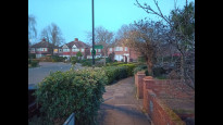
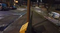
Plumstead Common is another nice spot, more varied than it looks on a map. Plumstead Common Road is the noisy part of the walk and where you leave or join the Green Chain. The road down to Woolwich is quieter and, believe it or not, one of the least steep ways down this hill.
-
Share your thoughts
Share your views about this route, give it a star rating, indicate whether it should be verified or not.
Include information that will be useful to others considering to walk or wheel it.
You can add up to 15 photos.
Other Routes for Eltham—Woolwich See all Slow Ways
Review this better route and help establish a trusted network of walking routes.
Suggest a better route if it better meets our methodology.
Share your thoughts