Cullompton — Honiton
Culhon two

Slow Way not verified yet. Verify Culhon here.
Slow Way not verified yet. Verify Culhon here.
By Lucy Mottram on 08 May 2022
Description
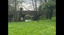
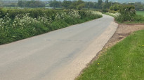
This route between Cullompton and Honiton travels through Mid and East Devon on quiet lanes and some footpaths. It passes through several villages where there are opportunities to refill water bottles or purchase food and drink. It stays away from the fast main roads so is safer than some routes
This route between Cullompton and Honiton travels through Mid and East Devon on quiet lanes and some footpaths. It passes through several villages where there are opportunities to refill water bottles or purchase food and drink. It stays away from the fast main roads so is safer than some routes
Status
This route has been reviewed by 1 person.
There are no issues flagged.
Photos for Culhon two

Photos of this route will appear when they are added to a review. You can review this route here.
Information
Route status - Live
Reviews - 1
Average rating -
Is this route good enough? - Yes (1)
There are currently no problems reported with this route.
Downloads - 2
Surveys
We are working to build-up a picture of what routes look like. To do that we are asking volunteers to survey routes so that we can communicate features, obstacles and challenges that may make a route desirable or not.
Slow Ways surveyors are asked to complete some basic online training, but they are not vetted. If you are dependent on the survey information being correct in order to complete a route, we recommend that you think critically about the information provided. You may also wish to wait until more than one survey has been completed.
Help people know more about this route by volunteering to submit a survey.
- Complete the survey training.
- Submit a survey for this route.
Geography information system (GIS) data
Total length
Maximum elevation
Minimum elevation
Start and end points
Cullompton
Grid Ref
ST0209407455
Lat / Lon
50.85828° / -3.39241°
Easting / Northing
302,094E / 107,455N
What3Words
rucksack.eminent.pokers
Honiton
Grid Ref
ST1634200722
Lat / Lon
50.79999° / -3.18849°
Easting / Northing
316,342E / 100,722N
What3Words
trip.empire.snows
| Cullompton | |
|---|---|
| Grid Ref | ST0209407455 |
| Lat / Lon | 50.85828° / -3.39241° |
| Easting / Northing | 302,094E / 107,455N |
| What3Words | rucksack.eminent.pokers |
| Honiton | |
|---|---|
| Grid Ref | ST1634200722 |
| Lat / Lon | 50.79999° / -3.18849° |
| Easting / Northing | 316,342E / 100,722N |
| What3Words | trip.empire.snows |
Sorry Land Cover data is not currently available for this route. Please check back later.
review
Lucy Mottram
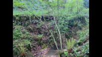
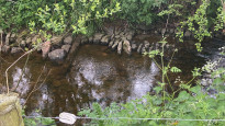
08 May 2022Good route, quiet roads and easy to navigate. Passes by a shop and pub for refuelling. Some parts would not be navigable by bike though.
Share your views about this route, give it a star rating, indicate whether it should be verified or not.
Include information that will be useful to others considering to walk or wheel it.
You can add up to 15 photos.
Other Routes for Cullompton—Honiton See all Slow Ways
Review this better route and help establish a trusted network of walking routes.
Suggest a better route if it better meets our methodology.
Share your thoughts